I first started writing this post about our second day in Thompson Pass after running into a retired older couple at a gas station in Teslin, Yukon. We had previously run into this couple in the Worthington Glacier parking lot right before we were about to hike up and ski down the glacier. They had come over to us and looked with interest at the parking spot full of all the gear we were going to bring. When this couple saw our camper again in the parking lot in Teslin, Yukon they ran up rather excitedly and gave us a very grandmother-like “Oh dears, thank God your alive!”. They just laughed and shook their head as we recounted some of the story to them. This hasn’t been an uncommon reaction to what we’ve been doing so far. A good portion of the people we’ve met on our trip have been at least 40 years older than us and tend to shake their heads and wonder why we’re doing the things we’re doing. If I could possibly bottle the feeling I got skiing down that huge glacier with no one else in sight simply surrounded by huge snowy white mountains and glacier I might be able to make them understand…But getting ahead of myself! The real work came with getting up to that point.
Likely some of this elder couples concerns came from the signs at the beginning of the trail with three different warning signs. But after reading the blog by Matt Kinney (backcountry guru from Valdez) who advised that you ignore the “nanny” advise by State Parks and a solo hike up by Thomas to scope it out we were pretty keen to go up and see if we could get another ski in.
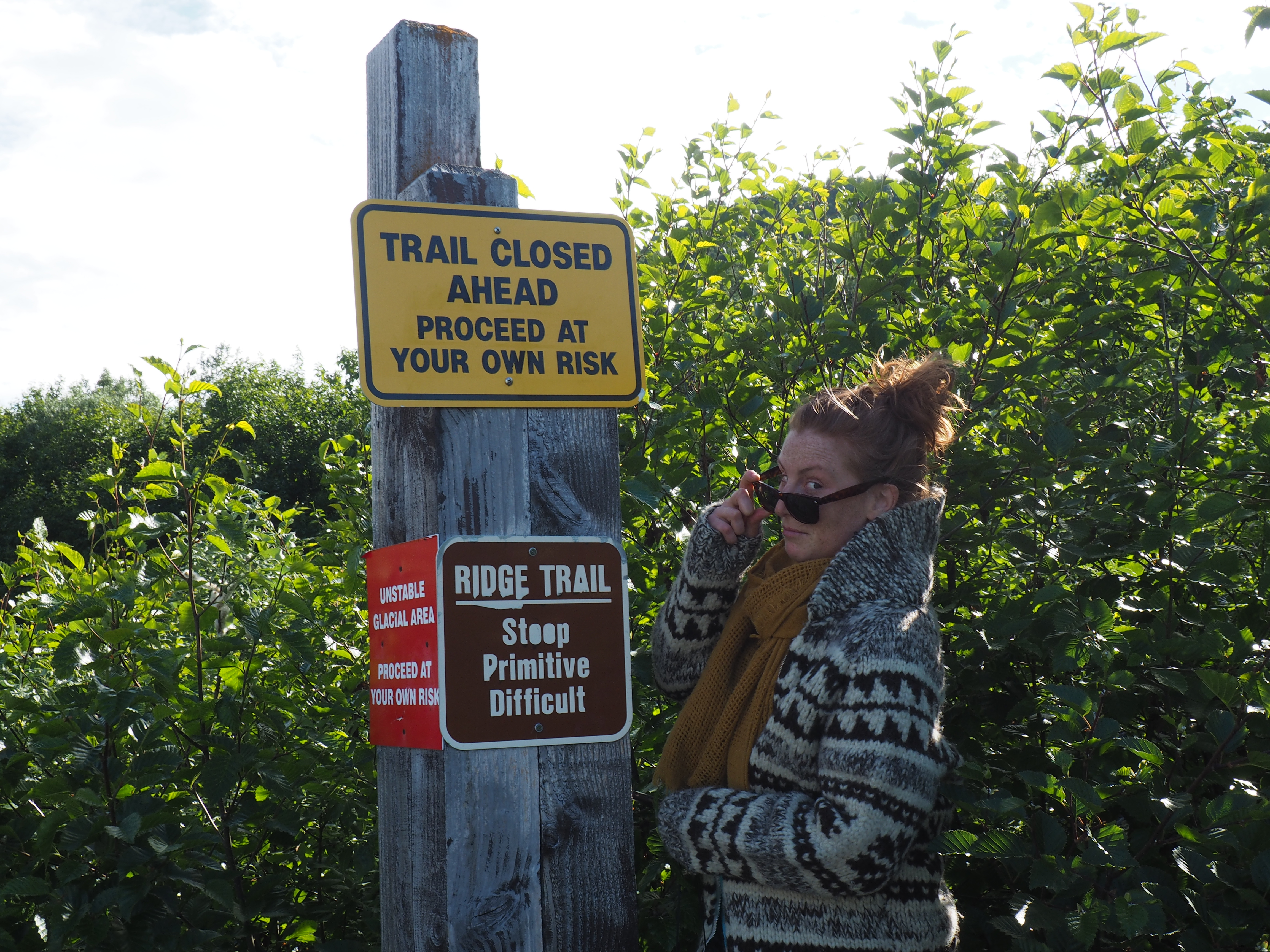
The first 50 meters of elevation gain were fairly straight forward, very steep but the trail was well marked. We tip toed our way up the first part of the trail until making it out of the brush and onto the ridge. This is followed by the gnarliest section of the trail that continually pushes you towards the edge of the ridge. You also need to jump over a couple of half a meter wide cracks that go down as far as the eye can see. Further to this you need to avoid the part of the trail that simply drops off into oblivion. Likely this is part of the reason for the signs at the beginning of the trail, it’s falling apart. Luckily for me, Thomas had gone up the day before, jumped over all the precarious cracks, noticed that some of the trail had fallen 100ft down into the glacier and found an alternate route around. We were able to descend down into the ravine beside the trail and after a bit of fun Alaskan bush whacking we avoided this section entirely. I was very happy about this given that I’m slightly less then graceful carrying a full pack with skies and boots attached to me over large cracks.

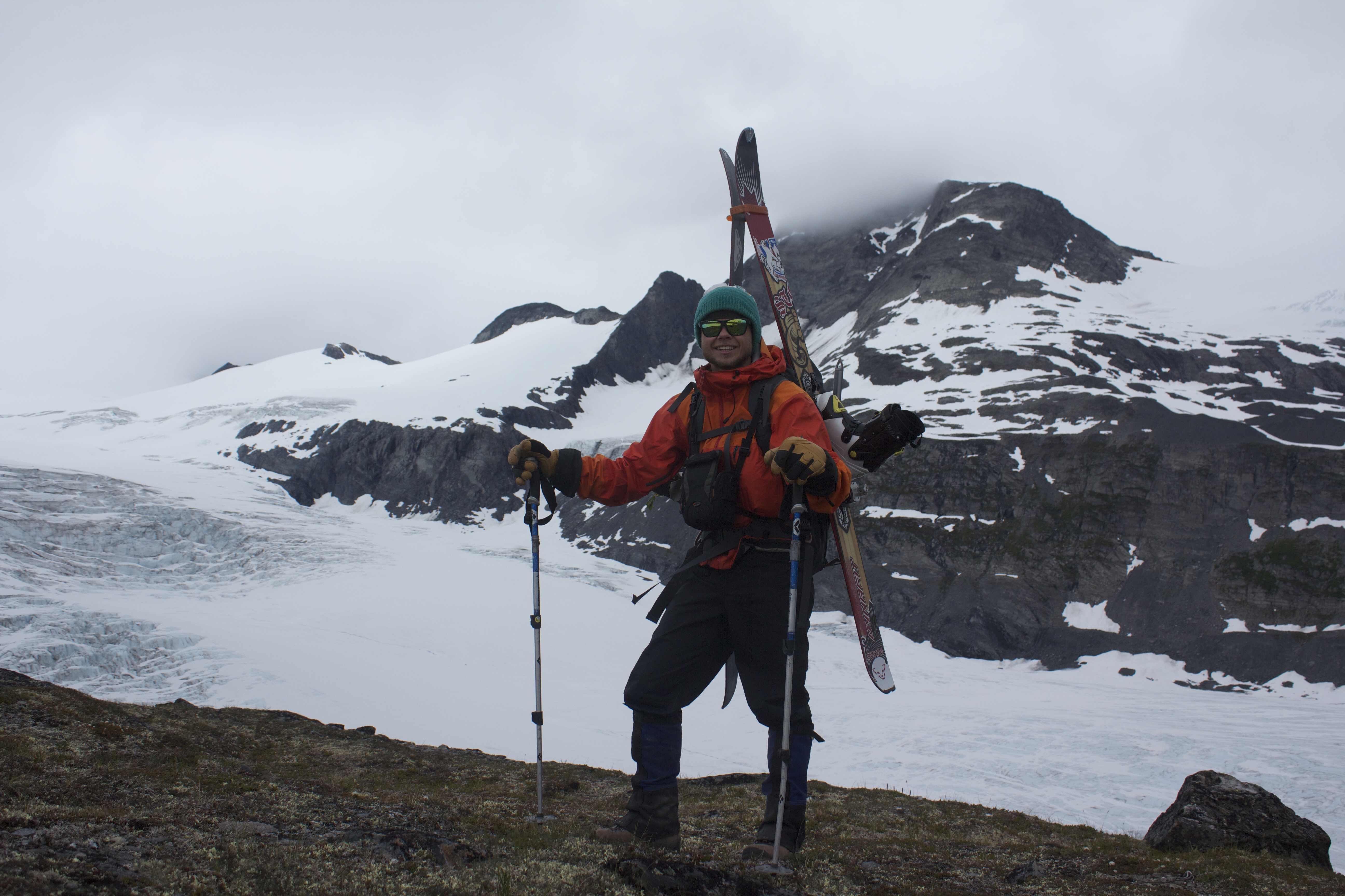
The next section of the climb was a steep but straightforward hike up the side of the moraine followed by a bit of scrambling to the section where we could put our skins and skis on! A bit of glacier information for those of you who havent spent much time on those icy peaks. Moraines are large piles of debris from when the glacier formed, pieces of rock and silt ranging in size from small pebbles to large sharp boulders.

After getting ski gear on, we put our harnesses on and roped up. This being my first time to traverse across a glacier I was happy to have all the gear on. Not quite as happy with my lack of knowledge about crevasse rescue (I’d been given a 15 min crevasse rescue lesson in the parking lot right before hiking up). However, we chose a conservative route and never found the snowpack to be shallower than 1.5 meters, thick enough to still bridge crevasses.

After putting our skis on we skinned up the north side of the ridge until the incline increased so much we had to take our skis off and continue on foot. As we were boot packing the last 200 meters of elevation we got completely socked in with no more than 5 meters of visibility. This was the only time on the hike I questioned whether lugging up all this gear to the top of the glacier was worth it. About every Alaskan we’d met up until this point laughed at our quest for snow, socked in at the top for those last hundred meters I wondered if they were right. That thought was quick to dissipate when, about 20 meters down, the sky cleared up completely and we had fantastic views of the Worthington Glacier and Marshall Pass. With clear sky we set off on our reward for the hike up: a completely open run down to the middle of the glacier.

Legs burning from a long, fast ski down we fuelled up and skinned back up to the moraine. From there the hike down was pretty straightforward except for a slight detour in the brush area that led once again to some serious Alaskan style bushwhacking and a search for a lost pole segment after it was “eaten” by the bush.
Another day of hard work getting up to the snow, but the second day skiing in June made us pretty happy of what we accomplished in Thompson Pass. After a bit of dinner looking out to the glacier we had just tackled we set off for McCarthy, AK a tiny town (population 29) to search for our next adventure.
